

The Point of Sleat Walk can leave you breathless as you trek uphill and down repeatedly. But there can be no denying that this varied and steep terrain creates a medley of spectacular landscapes.
Various dips, streams, steep cliffs, rocky shorelines and views out to sea, provide a feast for the eyes. On the way to the southernmost point of Skye, you can frolic on a sandy beach and view the isles of Rum, Canna and Eigg from a modern lighthouse.
So lace up your walking shoes and let’s get going!

WALK STATISTICS
- Location: The southernmost point of Skye, on the Sleat Peninsula
- Distance: 8.9km (5.5miles)
- Ascent: 400m
- Time To Complete: 3-4 hours
- Difficulty: Medium
- Terrain: Mainly rough stony track, a moorland path and one steep hill. It can be boggy underfoot in places.
CAR PARK FOR POINT OF SLEAT WALK
There is a car park at the very road end, just past Aird Old Church Gallery entrance. From Armadale (A851) turn right onto a B road and continue to the end.
Be aware that parking is actually at an extended working farmyard, so it’s essential that you don’t block any access gates.
TIP: If there is no space available, drive back up the B road and you can park in a layby.
POINT OF SLEAT ROUTE MAP
The walk uses the same path there and back and is easy to follow. Whilst hard work in places, there is only one steep hill to navigate. Whilst views are best on a clear day the walk can be enjoyed in most weather conditions.
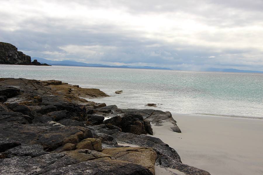
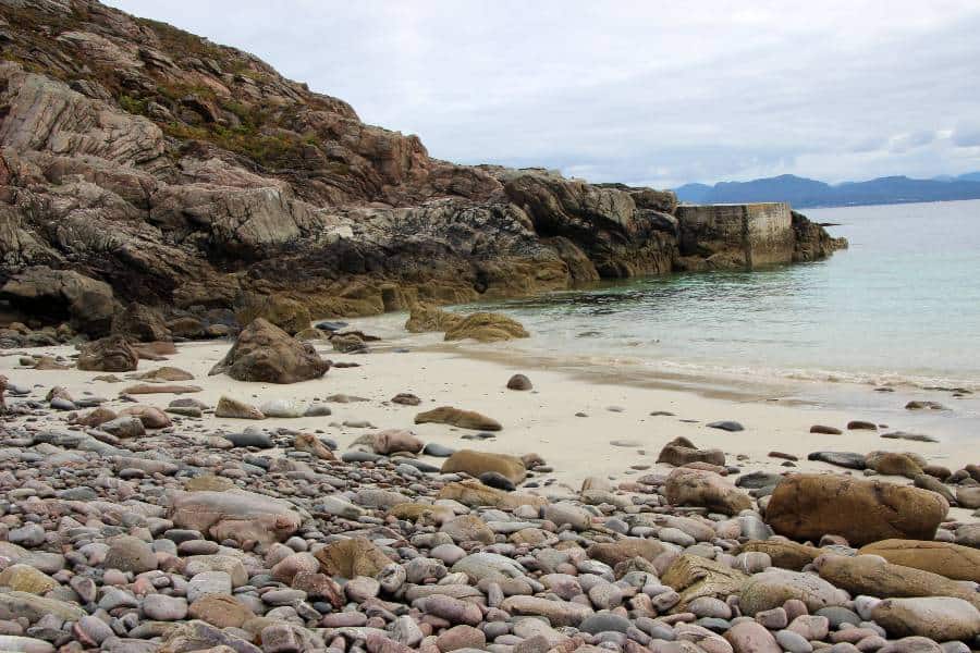
TIP: If you plan to spend some time at Camas Daraich Beach, which we highly recommend, check the tide times before setting out. The lower the tide, the more of the blissful white sand that will be exposed.
WALK DESCRIPTION
STAGE ONE
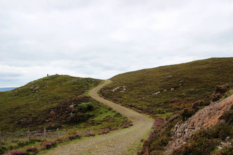
Pass through the wooden gate next to the large metal fam gate and join the well worn track through heather moorland.
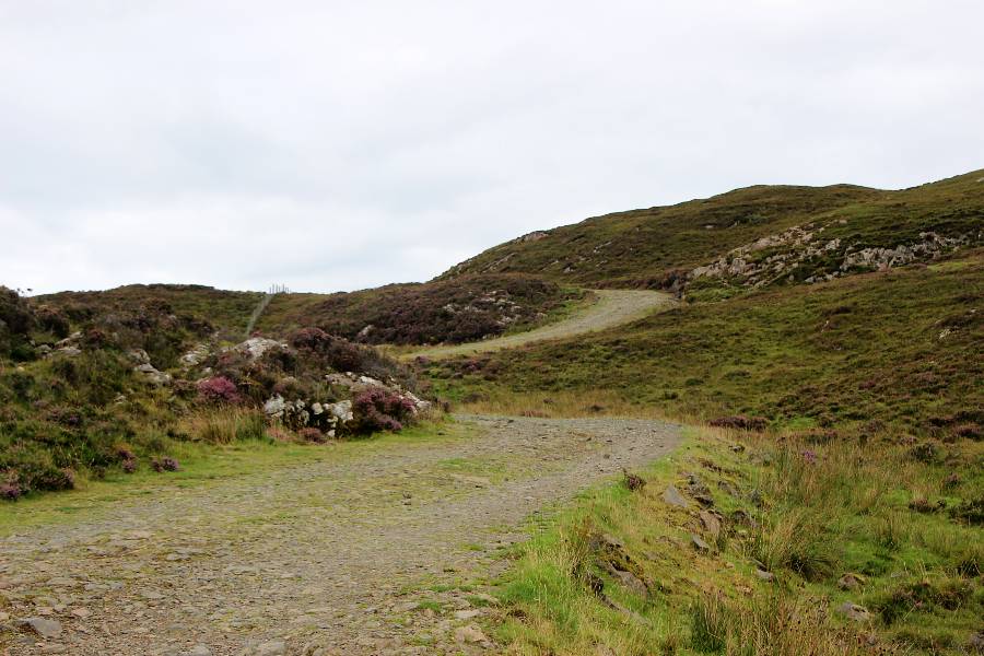
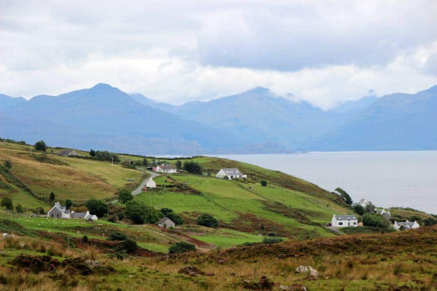
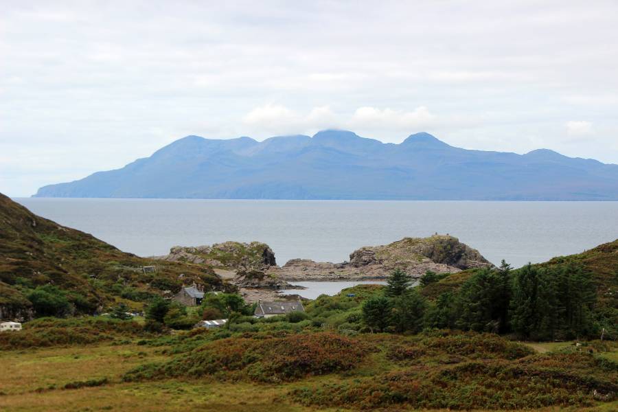
As the track climbs up the hillside, you are afforded great views back towards the Aird township and out to sea to the mainland.
Continue along the track as it twists and turns uphill, undulating across barren moorland, until it reaches a summit.
STAGE TWO
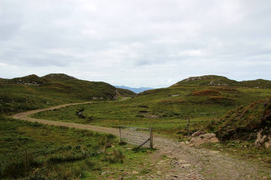
The track then descends and after a fair distance you will reach a metal gate with a wired fence either side.
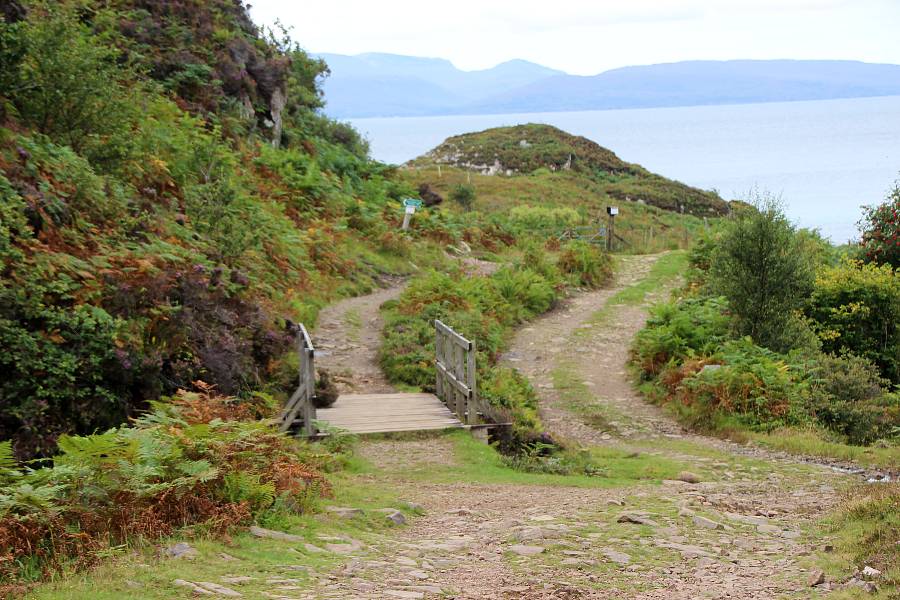
As you pass through the gate stay on the track as you drop downhill alongside a stream, and after a while you will come to a wooden bridge. Cross over and take a left hand turn by a green sign, pointing the route up a steep rocky path, signposted for the Point of Sleat.
STAGE THREE
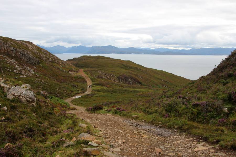
Follow the steep path up the bank keeping the wire fence on your right hand side. It is often muddy and uneven underfoot, but easy to follow. You will see a very small scatter of houses below, and views to the right of the Isle of Rum.
After a while the path drops downhill passing through a valley and leading to the shoreline. At the marker post, continue straight ahead to the beautiful white sands of Camas Daraich, and a perfect spot to stop for lunch.
STAGE FOUR
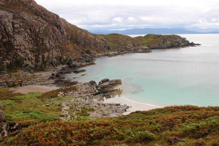
From the beach make your way back to the marker post and head left up the grassy bank to rejoin the path. As the path rises, stop and look below to your left and you will get a better view of the tropical blue waters around the beach.
Continue along the rough and boggy path crossing heather moorland until you reach a small gorge. A set of old well-worn concrete steps leads to the gorge floor which is grassy and wet in places.
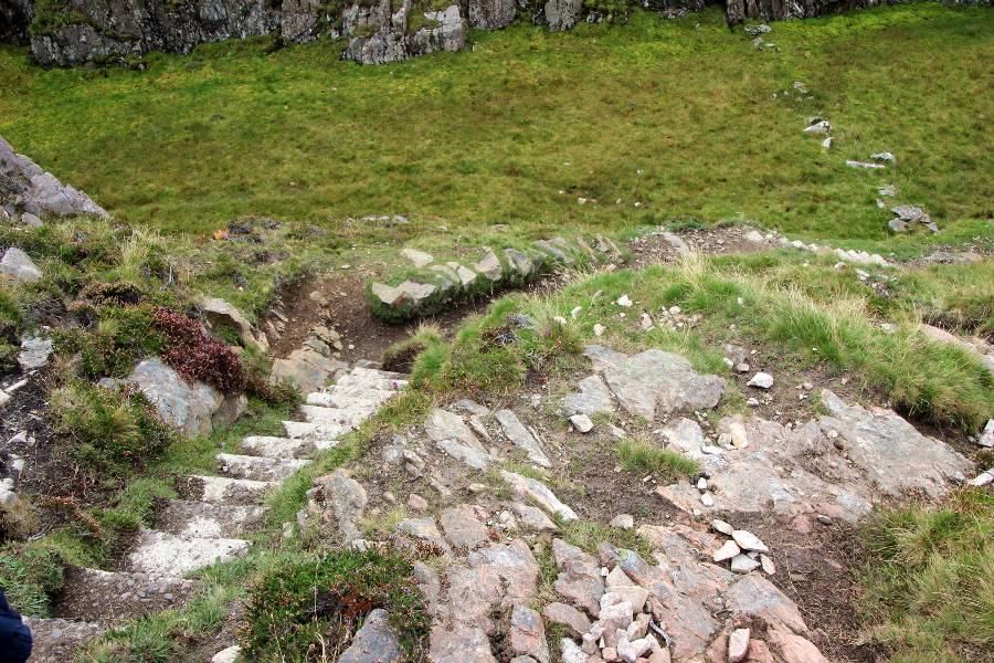
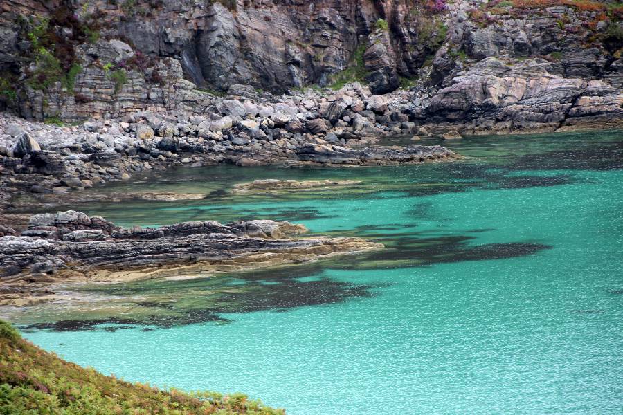
Walk across the stepping stones and after crossing a very muddy section, the path meets the rocky north shoreline of the peninsula, and bears left.
You will reach a grassy strip between two bays, with the left hand one having its very own tiny secluded white beach.
STAGE FIVE
The path continues up a grassy knoll becoming clearer at the top. It is a short distance from this point over the grass path to the Point itself. The lighthouse comes into sight on a rocky outcrop.
You may be disappointed as we were, to see that the lighthouse is now a modern, unmanned and automatic structure, which was helicoptered into position. While not particularly pleasing to the eye, the walk is all about the incredible views from the lighthouse.
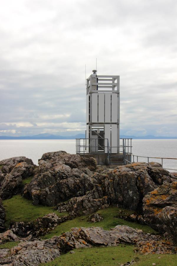
The sweeping views on a clear day take in the small Isles of Eigg and Rum, Mallaig, Rubh an Dùnain peninsula, and Britain’s most westerly mainland the remote Ardnamurchan peninsula.
Find a place to sit, enjoy the silence and if you are lucky you may even spot dolphins!
STAGE SIX
When you are ready to leave, the route back to the car park is the same as the outward route.
PLAN YOUR VISIT
- As most visitors choose the Old Man of Storr and The Quiraing walks first, you will hopefully find this walk less crowded. The best times to visit are early morning and late afternoon.
- The Sleat Peninsula is located 4 miles from Armadale (13 minutes) and 46 miles from Portree (75 minutes).
- If the car park is full, park in a layby further back up the B road.
- There are NO amenities at the car park, so bring snacks and water with you.
- If it is wet or raining, hiking shoes are advisable
And there you have it! If you have any questions about this walk, please do ask and I will do my best to answer them.
MORE INFORMATION ABOUT THE ISLE OF SKYE
- MAN OF STORR | Old Man of Storr Walk, Isle Of Skye Scotland
PIN FOR LATER:
This post may contain affiliate links, which means we may receive a small commission, at no additional cost to you, if you make a purchase through this link. This income goes towards the sites running costs and enables us to provide our readers with free content. Read our Disclosure.