
Solid blue-tinted Root Glacier is one of the most accessible glaciers in Alaska. Wrangell-St. Elias National Park has 5,000 square miles of glacial ice, so having a part that you can reach via a trail is incredible.
Highlights include great vistas of Mt. Blackburn, Regal mountain and Donaho Peak, plus of course a fantastic glacier view.
Whether you follow root glacier hike for an overlook view, to reach the toe of the glacier or don crampons to explore the ice slopes, you’re guaranteed a thrilling experience in one of Alaska’s most spectacular national parks.

HOW TO HIKE THE TRAIL
TRAIL FACTS
- Distance: 4 miles round-trip
- Difficulty: Easy to Moderate including loose scree
- Elevation: Relatively level with moderate elevation gain and drop (380ft-400ft)
- Time To Walk To Glacier Toe: 2-3 hours there and back
- Coordinates: Latitude: 61.48694689 | Longitude: -142.8905225
- Be Bear Aware: Bears can be encountered along the entire route, as can moose, so make noise and stay alert.
- Root Glacier Camping: About 1.5 miles from Kennecott at Jumbo Creek Campground (free but no facilities)

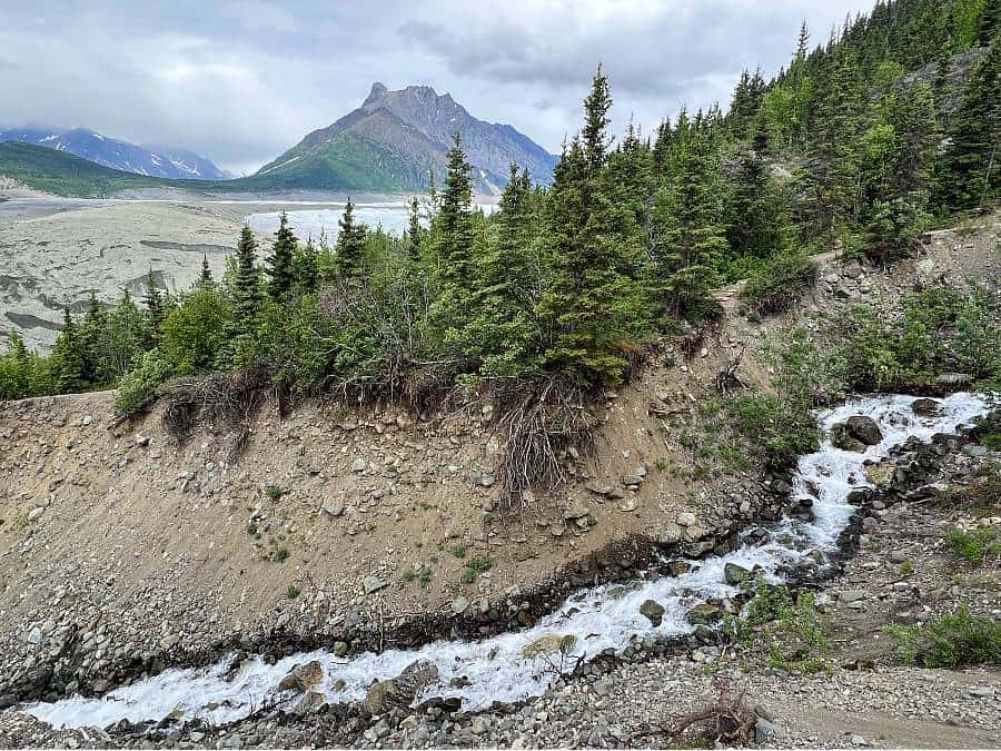
Standing along the banks of the Kennicott River, the rock and rubble you see is actually the receding toe of the Kennicott Glacier and not mine tailings. The gravel-covered silt mounds fill the four-mile wide valley stretching back to its source uphill on Mount Blackburn.
The glacier is hidden by the mass of debris that has been carried down the valley for centuries. Don’t worry though Root Glacier looks like a typical glacier, icy and white with blue hues.
AERIAL VIEW OVER THE TRAIL

STARTING POINT OF THE ROOT GLACIER HIKE
Pick up a root glacier trail map from Kennecott Visitor Center, then walk along the main street past the red and white mill buildings to the north end of Kennecott mill town.
After about half a mile the road splits in two, keep left to join the glacier trail proper.

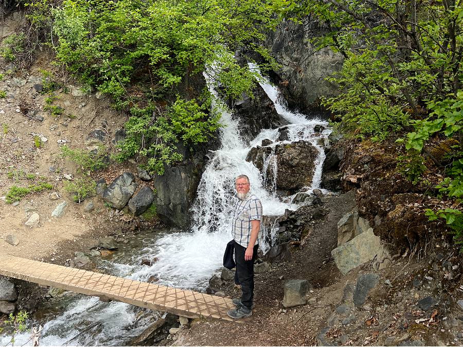
The dirt trail running parallel to the glacier weaves in and out of forest with beautiful spring/summer flowers alongside the path. Originally this trail served as a wagon road supplying Erie Mile located further up the valley.
The trail crosses two creeks via small foot bridges. These clear-water streams originate from snow melt or springs as opposed to Kennicott River whose water primarily comes from melting glacier ice.
Cross over Bonanza Creek first, then continue along the trail for about a mile when it curves sharply uphill and to the right. This is your first glimpse of what is to come.
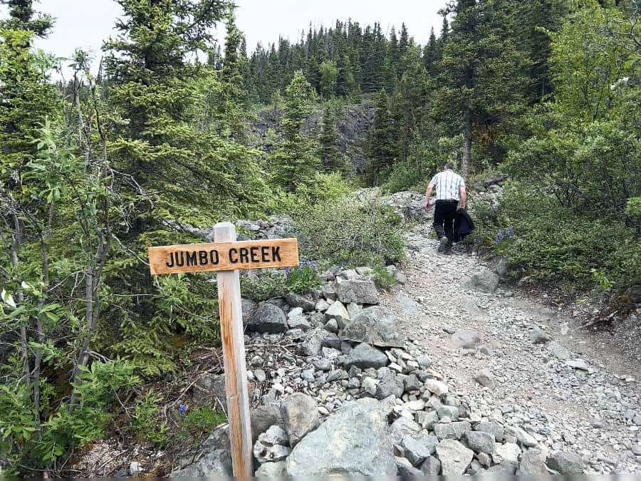
About 15 minutes after crossing Jumbo Creek, take the clearly marked side trail on the left.
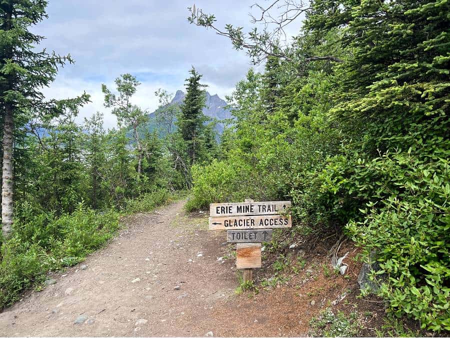
From the top you will be afforded spectacular views of Donaho Peak and rock-covered Kennicott Glacier.
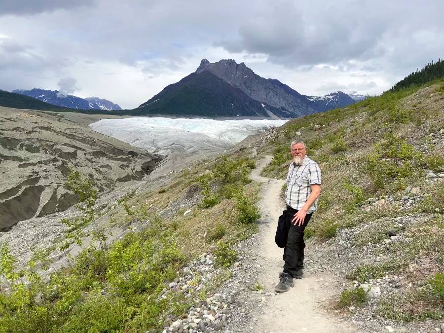
The loose gravel trail gradually descends downhill from here, winding its way steeply through the lateral moraines of Kennicott and Root Glaciers.

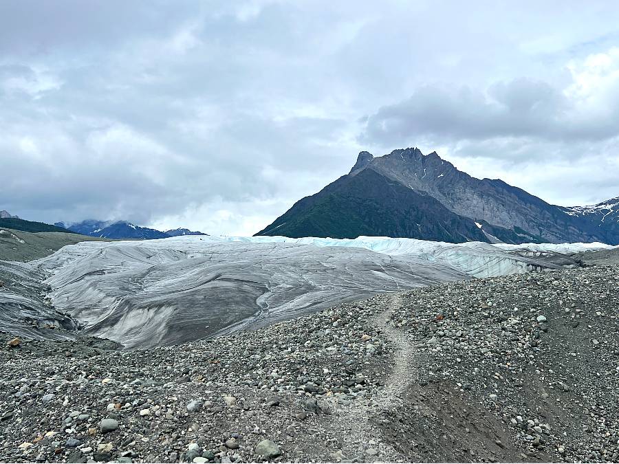

After the rough twisted and rugged looking Kennicott glacier, the white ribbon of ice is a welcome change.
Root glacier access leads to undulating slopes, blue-tinted ice, slot canyons and moulin drain holes waiting to be explored.
The expanse of exposed ice is slippery and caution is required if walking on the glacier.
SAFETY TIPS FOR WALKING ON THE GLACIER
Glaciers are continually on the move, unpredictable and conditions on the ice can change quickly. It is important to treat them with respect and adhere to basic safety facts:
- Avoid walking along the edge of the ice as swift cold water and rotting ice can potentially be dangerous.
- Remember if you do manage to scramble up the glacier face you may find it too slippery to descend safely.
- Never approach crevasses and drain holes. Be aware that unmelted snow may actually be bridging a hole.
Unless you are experienced in glacier hiking the best way to explore the ice further is to join a tour.
TAKING A ROOT GLACIER TOUR
Two small group tours are offered which are both highly rated. We researched both prior to our trip but ended up not having the time to take a tour. Instead we hiked the trail ourselves and walked a short distance onto the ice.
Guided hikes are usually offered from the end of May through to mid September.
Dress in layers so that it is easier to accommodate temperature differences.
1. KENNICOTT WILDERNESS GUIDES
- Located in downtown Kennecott across from Kennicott Glacier Lodge.
- Shuttle to and from McCarthy included.
- Half-Day hike (4-5 hours) includes a historical tour through Kennicott mill site, hiking with crampons on the glacier to view waterfalls, crevasses, blue pools, and moulins. $105pp.
- Full-Day hike (7-8 hours) basically gives you longer on the ice to see seldom visited areas of the glacier. $145pp
- Check out these and other tours such as ice-climbing on their official site.
2. ST. ELIAS ALPINE GUIDES
- Located in downtown McCarthy.
- Half-Day Hike (3 hours) includes seeing amazing glacier features such as blue pools, waterfalls, canyons, crevasses and more. $105pp
- Full-Day hike (8-9 hours) is more strenuous as you’ll get to go further out on the glacier, where the terrain can be more challenging and varied. Plus you get to jump into a Blue Pool! $145pp
- Check out these and other tours on their official site.


HOW DO YOU GET TO ROOT GLACIER?
Root Glacier is in the heart of Wrangell-St. Elias National Park, about seven miles beyond the end of the McCarthy Road. There are several ways to reach McCarthy which include:
1. From Anchorage
Driving about 310 miles east from Anchorage via the Glenn, Richardson and Edgerton Highways, taking 6-8 hours. This is then followed by a 60-mile trip along the McCarthy Road. **Many rental companies do not allow their vehicles on this section of road, so check your insurance**
At the road end there is free parking to leave your vehicle. Walk or cycle across the pedestrian bridge where you can pick up a shuttle bus for $5 (one way) to Kennecott, from where you pick up the trailhead.
2. Travel By Shuttle
Vans connect Anchorage, Glenallen, Chitina and McCarthy into the scenic Wrangell-St. Elias National Park and Preserve. While it isn’t cheap, it saves wear and tear on your vehicle plus you get a voucher for shuttle transportation to McCarthy & Kennicott. The schedule and reservation details can be checked on their official site.
If you have any questions on how to hike the root glacier trail or want to share your own experience, please comment in the section below.
This post may contain affiliate links, which means we may receive a small commission, at no additional cost to you, if you make a purchase through this link. This income goes towards the sites running costs and enables us to provide our readers with free content. Read our Disclosure.